


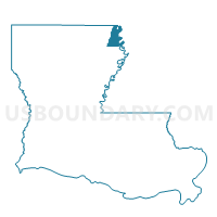
Precinct 13A, East Carroll Parish, Louisiana
About
Outline

Summary
| Unique Area Identifier | 588719 |
| Name | Precinct 13A |
| County | East Carroll Parish |
| State | Louisiana |
| Area (square miles) | 0.13 |
| Land Area (square miles) | 0.13 |
| Water Area (square miles) | 0.00 |
| % of Land Area | 100.00 |
| % of Water Area | 0.00 |
| Latitude of the Internal Point | 32.80683430 |
| Longtitude of the Internal Point | -91.17858000 |
Maps


Graphs
Select a template below for downloading or customizing gragh for Precinct 13A, East Carroll Parish, Louisiana


Neighbors
Neighoring Voting District (by Name) Neighboring Voting District on the Map
- Precinct 1, East Carroll Parish, LA
- Precinct 13, East Carroll Parish, LA
- Precinct 14, East Carroll Parish, LA
- Precinct 6, East Carroll Parish, LA
Top 10 Neighboring County Subdivision (by Population) Neighboring County Subdivision on the Map
- District 5, East Carroll Parish, LA (753)
- District 6, East Carroll Parish, LA (747)
- District 9, East Carroll Parish, LA (730)